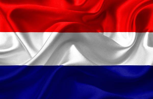
Netherlands and Holland: difference and map
Today, many are the people who do not know what the difference between the Netherlands and Holland and, on many occasions, this is given by the media as they use the two terms indiscriminately. In this lesson from a TEACHER we are going to talk about Netherlands and Holland: differences and map. Here we will comment on the differences that exist between the two names and where they are located on the European map in order to make it clear what each term refers to.
Index
- Differences between the Netherlands and Holland
- Why is the Netherlands so famous?
- The emergence of the Netherlands
Differences between the Netherlands and Holland.
The Netherlands is a kingdom formed from the year 1830, that is to say, after the Napoleonic wars, a moment in which Europe was immersed in the reconstruction of its map, attending to the emergence of its own nationalist sentiments.
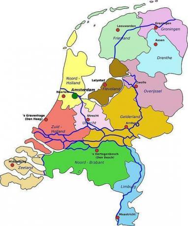
Among them we will find the one from the area of the Netherlands, which were not considered to be French or German, but had their own identity. This kingdom would be made up of 12 provinces:
- North brabant
- Drenthe
- Flevoland
- Friesland
- Gelderland
- Groningen
- South holland
- North holland
- Limburg
- Overijissel
- Utrecht
- Zealand
In this way you will have been able to verify that Holland is one of the provinces of this kingdom, being the capital of this The Hague (South Holland) and Haarlem (North Holland). Being the capital of the kingdom Amsterdam.
Why is the Netherlands so famous?
To understand the confusion between the term of Netherlands and Holland We must go back in time to the 17th century, when the Dutch controlled much of the European trade, in addition to having many colonies throughout the globe.
On the other hand, The Netherlands is the province with the most access to the sea and most of the major cities in the Netherlands reside in these provinces. It should also be taken into account that most of the commercial networks always linked to that place, making evident the importance it had over time.
Holland is located to the west of the Netherlands, at the mouth of the Rhine and Meuse rivers, it also has numerous rivers, lakes and an inland canal. It is protected from the sea by a long line of dunes "polders", which are land areas reclaimed from the sea.
Today it is necessary to drain the channels it has so that the region does not flood, formerly, the counts of Flanders, devised a way to dry and gain ground from the sea, being the case of the famous windmills that are found throughout its geography.
The appearance of the Netherlands.
Once we have understood why the Dutch provinces are so important, we must comment how the kingdom of the Netherlands was created. After the Congress of Vienna, the north and south of the Netherlands were unified under the same monarch, William I in 1815.
Although this union lasted rather shortly due to the social, economic, linguistic and religious differences between the north and the south. For all this in the year 1830 we will find the independence of Belgium from the Netherlands, which were aided in turn by the French, who saw Belgium as a much-needed buffer state between France and Amsterdam.
Another great event would take place in the year 1848, at which time the monarch William II promoted a series of reforms democratic and liberal that ended up taking power away from it, giving it the constitutional character that exists today in said State. In this way, although he lost power, he could remain on the throne, because in the rest of Europe At that time, liberal revolutions were taking place and all the monarchies were suffering them.
In the last decade of the S XIX, we will find the loss of Luxembourg, due to the fact that a woman, Guillermina and given that the title of duke could only be inherited by a male, they lost said territory. After the first and second world wars, the Netherlands stopped having colonial belongings (like the rest of European countries). This territory suffered quite a lot from the consequences of these wars for being a strategic place for trade and for the passage of ships in general.
If you want to read more articles similar to Netherlands and Holland: difference and map, we recommend that you enter our category of Geography.